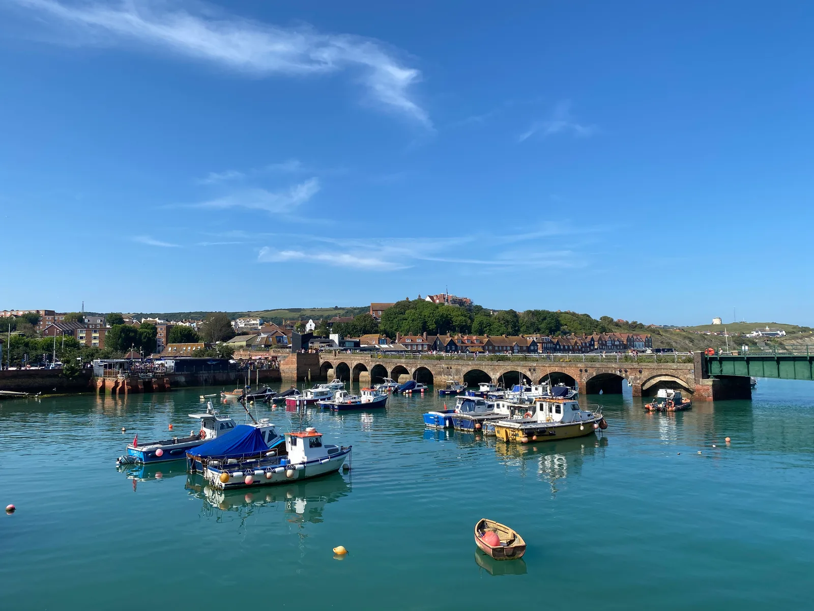

The harbour operator currently allows pedestrians to use the viaduct route towards the restored station and Harbour Arm. Access is permissive and can change with weather, events or local works. Stay on marked public routes; do not enter the harbour water, railway structures or closed areas. Check the operator’s latest visitor and access pages before travel.
Check the official visitor information ↗ · checked 2026-09-28
Use public paths and visitor areas. Do not enter unstaffed tunnels, shafts, railway land or restricted property.
Advice before you visitInformation checked 2026-09-28. Historic England listing, harbour restoration account and current operator visitor notices checked. No site visit or direct operator confirmation.
A bridge between train and boat
South Eastern Railway built the viaduct in 1843 so trains could reach Folkestone Harbour. Its thirteen brick arches cross most of the inner harbour. The company wanted passengers and goods to change between railway and ship at the same port, rather than end their rail journey elsewhere and continue by road.
A swing bridge was added by 1847 to carry trains across the remaining water to the southern side. The present steel bridge dates from 1930 and rests on a base left from its 1893 predecessor. That makes the crossing a sequence of railway improvements, not one structure completed in a single year.
- Folkestone Harbour Viaduct and Swing Bridge (1404114) ↗ · reviewed 2026-09-28
A public route with changing conditions
The harbour railway closed in 2014. The viaduct and station were then restored as part of a pedestrian route towards the Harbour Arm. The former tracks and platforms help visitors read the shape of the old interchange while using it in a new way.
The Harbour Arm operator says access is permissive. Its 28 September 2026 update reported the viaduct open to pedestrians, but also described a temporary road diversion nearby. Check that page before travelling. The operator provides alternative accessible routes and says the beach boardwalk is not recommended for wheelchair or mobility-scooter users; it does not guarantee that every surface or business is accessible.
- The Station: design and restoration ↗ · reviewed 2026-09-28
- Folkestone Harbour Arm: plan your visit ↗ · reviewed 2026-09-28
- Plan your trip: September 2026 access update ↗ · reviewed 2026-09-28
What we still need to check
Historic fabric and dates are supported by the official listing. We have not inspected the bridge or tested the route. Permissive access, temporary diversions and accessible approaches can change; follow the operator’s current notices.
Sources for the visiting information
- Folkestone Harbour Arm: plan your visit ↗ · reviewed 2026-09-28
- Plan your trip: September 2026 access update ↗ · reviewed 2026-09-28
About the original record
This place is recorded by Historic England / Planning Data. The details below include the original description of its building or site type.
Some historic railway structures still carry trains. Being in this category does not mean a line is closed or open for walking.
Place details
- Category
- Lost railways & rail heritage
- Building or site type (original wording)
- Folkestone Harbour Viaduct and Swing Bridge
- Period or date
- Viaduct built 1843; present swing bridge built 1930; pedestrian restoration completed by 2018
- Current condition
- Not checked in person
- Heritage protection
- II
- Date protection was granted
- 2012-01-23
- Nearby town
- Folkestone (approximate)
- County named in the original record
- Kent
- Current county or council area
- Not matched to an area
- Nation
- England
- Original record number
- 1404114
- Coordinates
- 51.079252, 1.186836 (reference point, not an entrance)
- Heritage data checked
- 2026-09-13
- Source last updated
- 2026-09-12
- Visitor information checked
- 2026-09-28
We checked the downloaded heritage record on 2026-09-13. We have not visited or inspected the site. The map point may refer to a whole site, one structure or a location where little remains.