BRITAIN BENEATH · GUIDE · 8 OCTOBER 2026
Cramond Island: The Concrete Line Built to Block Ships
Concrete posts beside Cramond’s tidal crossing once formed a connected barrier against fast-moving boats. Guns and a searchlight defended the approach between mainland and island.
Based on published records and visitor information. We have not visited these places.
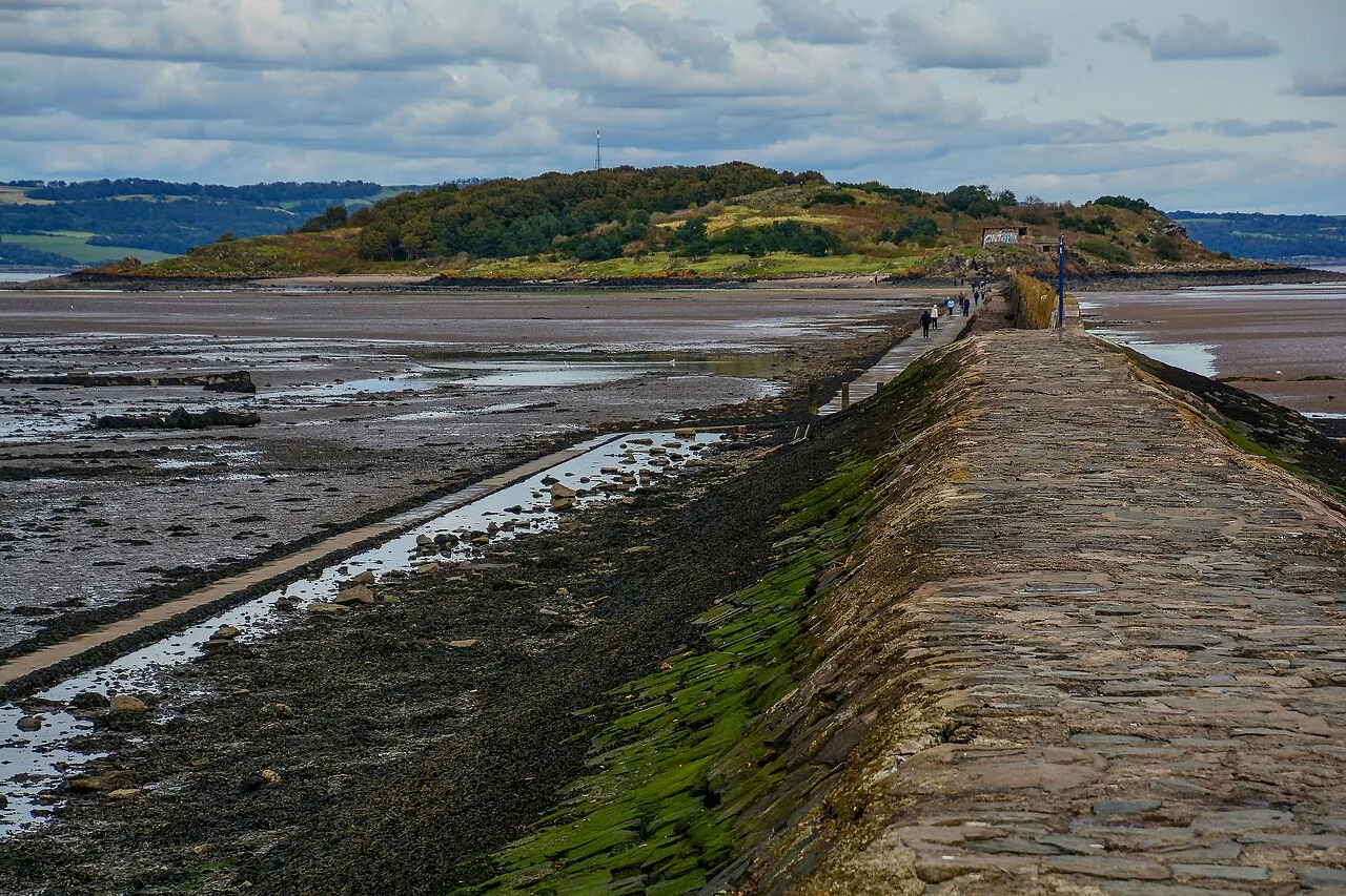
The crossing towards Cramond Island in September 2020. This photo cannot tell you today’s safe crossing times.
Cramond causeway by Lewis Clarke · CC BY-SA 2.0. Wikimedia rendition converted to WebP and resized where needed; no cropping or retouching. Photographic derivatives remain under the stated licence.

A barrier between shore and island
The concrete posts beside Cramond’s causeway once held connected sections of a barrier. It was designed to block fast-moving craft on the surface of the water between the mainland and island.
At the Knoll on Cramond Island’s southern shore, a gun position and searchlight covered the approach. Historic Environment Scotland records their connection with the barrier and the wider defence of the Firth of Forth.
The posts can be seen without entering the military buildings. Crossing to the island is a separate decision governed by the tide: use current safe-crossing advice and leave enough time to return. Stay on the mainland if the crossing is uncertain.
- Historic Environment Scotland — Cramond Island defences SM13684 ↗ · reviewed 2026-10-07
- RNLI — Cramond tidal crossing warning, April 2026 ↗ · reviewed 2026-10-07
Different jobs in the island defences
Cramond’s military history covers both world wars. The official record describes a battery established from 1915 and later work from 1938. Guns, searchlights, engine houses and living quarters served the wider defence of the Firth of Forth.
The barrier was designed for surface craft. A separate recorded mooring block relates to a submarine boom—a barrier intended to stop submarines—towards Inchcolm. These were different parts of the wider defence, with different purposes.
The crews needed power, stores and accommodation alongside their guns and searchlights. The engine houses and living quarters recorded on the island served those supporting tasks.
The records explain the barrier and Knoll position. They do not confirm safe entry to military interiors today. Reaching the island is not permission to enter the buildings; this guide gives no directions into them.
- Historic Environment Scotland — Cramond Island defences SM13684 ↗ · reviewed 2026-10-07
The tide controls the crossing
You can walk to Cramond Island only within the safe tidal window. The RNLI warns that visitors can be cut off. Check current safe-crossing information and weather before setting out, and allow enough time for everyone in your group to return.
An old photo of a dry causeway says nothing about today’s tide. This guide is not a live crossing timetable. Use latest advice at the shore and the RNLI’s advice. A general low-tide time does not replace the published safe-crossing window.
If you are unsure you can return in time, stay on the mainland. If the tide cuts you off, do not wade back. In an emergency, call 999 and ask for the Coastguard.
- RNLI — Cramond tidal crossing warning, April 2026 ↗ · reviewed 2026-10-07
Sources and further reading
Based on the linked official heritage records and visitor pages. We have not visited or confirmed access directly. Older descriptions and photos may not reflect today’s condition. Check current official visitor advice before travelling. The 1 place records below give more information.
- Edinburgh, Cramond Island, The Knoll — 106631
You can follow the links to read the original sources. Sources and permissions.