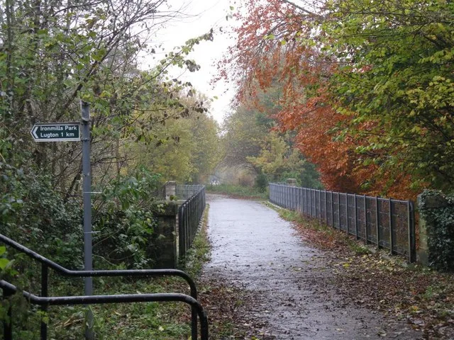

The railway deck is closed to public walking and cycling. The photograph shows a former path in 2008, before reopening. ScotRail operates the Edinburgh–Tweedbank route; check current services. No exterior viewing point or walking approach has been verified.
Check the official visitor information ↗ · checked 2026-10-07
Use public paths and visitor areas. Do not enter unstaffed tunnels, shafts, railway land or restricted property.
Advice before you visitInformation checked 2026-10-07. HES designation, matching Trove coordinates, original dating research, tribunal historical facts and Transport Scotland reopening evidence checked. No site visit or direct operator confirmation.
An early crossing of the North Esk
The heritage catalogue and the statutory listing share grid reference NT 32372 67136. Historic Environment Scotland dates the bridge to 1829–31 and attributes it to James Jardine. Its single stone arch carried the Edinburgh and Dalkeith Railway. The current designation is Category A.
Older archive notes contain different dates and descriptions. Paxton’s research challenged the 1847 construction account, and the designation adopted his earlier dating. These historical notes need to be read with their dates attached.
- Glenesk Railway Viaduct, LB1445 ↗ · reviewed 2026-10-07
- Edinburgh and Dalkeith Railway, Glenesk Bridge, Bridge No. 12 ↗ · reviewed 2026-10-07
- Edinburgh & Dalkeith Railway: Glenesk Bridge, Dalkeith — the case for an 1829–31 date of origin ↗ · reviewed 2026-10-07
A former path, now a railway
After the through railway closed, the bridge was restored under Edinburgh Green Belt Trust and used by walkers and cyclists. The 2008 photograph records that recreational phase. It does not establish present access.
The bridge was acquired for the railway project, and passenger services returned to the route in 2015. Do not enter the railway deck on foot or by bicycle. The point on our map marks the structure, not an entrance or a verified viewpoint.
- Edinburgh and Lothians Greenspace Trust v Network Rail Infrastructure Limited ↗ · reviewed 2026-10-07
- Borders Railway Year 1 Evaluation: Background ↗ · reviewed 2026-10-07
- Bridge over the River North Esk, photograph 1035626 ↗ · reviewed 2026-10-07
What we still need to check
No current site inspection or exterior viewing route. Some HES archive notes contain superseded dates and track-removal wording. Current rail service information does not guarantee an unobstructed view from a train. Direct access to the tribunal and Paxton PDF failed; relevant indexed primary-source text was checked.
Sources for the visiting information
- Edinburgh and Lothians Greenspace Trust v Network Rail Infrastructure Limited ↗ · reviewed 2026-10-07
- Borders Railway Year 1 Evaluation: Background ↗ · reviewed 2026-10-07
- Trains from Edinburgh (Waverley) to Tweedbank ↗ · reviewed 2026-10-07
About the original record
This place is recorded by Historic Environment Scotland — NRHE. The details below include the original description of its building or site type.
Place details
- Category
- Industrial relics
- Building or site type (original wording)
- RAILWAY VIADUCT (19TH CENTURY)
- Period or date
- Built 1829–31; consolidated 1993; railway passenger route reopened 2015
- Current condition
- Not checked in person
- Heritage protection
- Category A listed building, LB1445
- Date protection was granted
- 1971-01-22
- Nearby town
- Dalkeith (approximate)
- County named in the original record
- MIDLOTHIAN
- Current county or council area
- Midlothian
- Nation
- Scotland
- Original record number
- 144954
- Coordinates
- 55.892585, -3.08291 (reference point, not an entrance)
- Heritage data checked
- 2026-09-13
- Source last updated
- 2011-02-18
- Visitor information checked
- 2026-10-07
We checked the downloaded heritage record on 2026-09-13. We have not visited or inspected the site. The map point may refer to a whole site, one structure or a location where little remains.